The river Weser
The river course of the Weser characterizes the region and determines, together with the tributary Lesum, Bremen-Vegesack’s landscape and profile. The river Weser got its name from Hannoversch Münden on, where the both its headstreams, Werra and Fulda, join or „kiss.“At Bremerhaven, the river widens and flows as Upper Weser into the North Sea.
Wide and wild
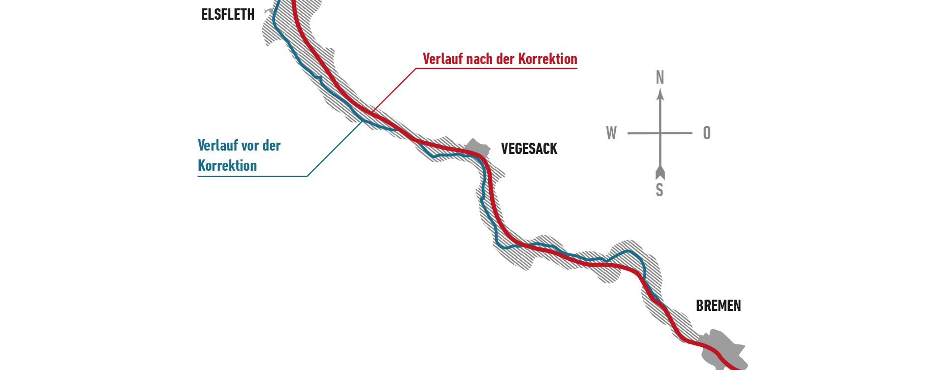
In former times, the Weser used to be a broad, wide river course which carried in winter much ice and was heavily silting in summer. Due to this siltation, the ships, continually increasing in size, could not reach Bremen any more.The port of Vegesack had been built around 1620, and after that, the town of Bremerhaven (around 1830)
Corrected and dredged
After the so-called Weser correction (1887-1885) by Ludwig Franzius, the Weser was made permanently accessible for shipping. He had a certain goal: Seafaring ships with 5 metres draught should be able to reach Bremen, by making use of the tidal range. Franzius indended to ‚keep the living force of the tidal wave and therefore the incoming and outgoing amount of water or the hydraulic pressure as high as possible, at any point, at any time‘.
Pros and Cons
The correction of the river Weser had advantages as well as disadvantages. Nature protectionists and ecologists assessed its impact in a critical way. For example, many banks of the river had to be stabilized, the tidal range became considerably greater, and high tide occurs more often. On the other hand, the correction meant also a reclamation of land for Vegesack: the so-called Vegesacker Kurve (Vegesack bend) was rebuilt, and in front of the Hohe Ufer, sand had been floated up so that the premises of the later Stadtgarten emerged. With its green terraces, the garden shows attractive vistas of the river Weser, shipping traffic and the adjoining parklands.


